
Wee History of Scotland’s Mountains and Hills
Scotland is the most mountainous country in the United Kingdom. The area north and west of the Highland Boundary Fault is known as the Scottish Highlands contains the country’s main mountain ranges. The southern and eastern parts of Scotland are usually referred to as the Scottish Lowlands, but these areas also have significant ranges of hills, although they are lower than the Highland mountains. Within the Lowlands are two regions: The Central Lowlands and the Southern Uplands. The Central Lowlands consists of rolling plains interrupted by volcanic outcroppings. The Southern Uplands form a continuous belt across southern Scotland from Galloway to the Borders and is divided into five local ranges.
The majority of the country’s population resides in the Central Lowlands, allowing the remote Highlands and Southern Uplands regions to remain unscathed by the advancements of civilization. Rugged and romantic, they are places of allure, places of dreams and escape.
However beautiful the environment, the history of these hills did not escape tragedy. Its long and complex history includes brutal battles and betrayals during the Wars of Scottish Independence, the 1692 Massacre of Glencoe and both the Highland and Lowland Clearances in which large segments of the population lost both their homes and their homeland. Nevertheless, these mountains and hills continue to offer both inspiration and relaxation to all who visit.
Scotland comprises the northern third of the island of Great Britain, off the coast of northwestern Europe. The total land mass is around 30,414 square miles. Scotland’s only land border is with England, running for 60 miles between the River Tweed on the east coast and the Solway Firth in the west.
The country consists of a mainland area plus several island groups. The mainland has three areas: The Highlands in the north; the Central Belt, and the Southern Uplands in the south. The Highlands are generally mountainous and are bisected by the Great Glen, which includes Loch Ness. The highest mountains in the British Isles are found there, including Ben Nevis, the highest peak at 4,409 feet. The Central Belt is generally flat and is where most of the population resides. This area is divided into the West Coast, which contains the areas around Glasgow; and the East Coast which includes the areas around the capital, Edinburgh.
The ‘Highland Boundary Fault’ is a geologic fault that traverses Scotland from Arran and Helensburgh on the west coast to Stonehaven in the east. It separates two distinctly different physiographic regions: the Highlands from the Lowlands, but in most places it is only recognizable as a change in topography.
The fault allowed the Central Uplands to descend as a major rift by as much as 4,000 meters, and there was subsequently vertical movement. This earlier vertical movement was later replaced by a horizontal shear. A complementary fault, the ‘Southern Upland Fault’, forms the southern boundary for the Central Lowlands region.
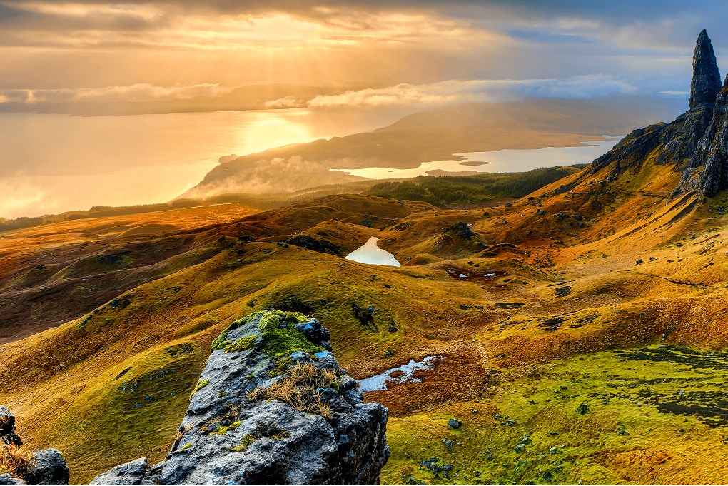
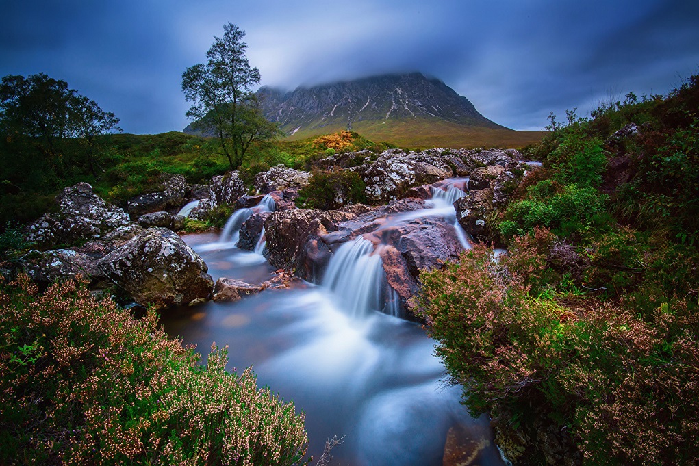
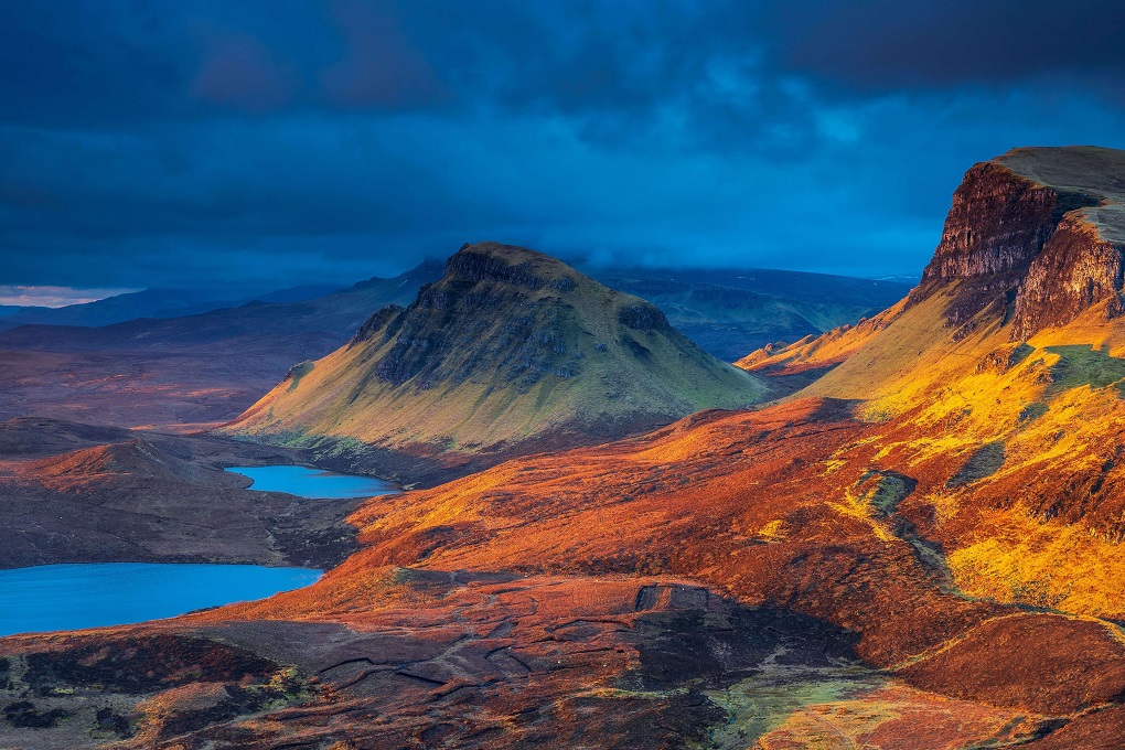
The Scottish Highlands include the rugged and mountainous regions of Scotland north and west of the Highland Boundary Fault, although the exact boundaries are not clearly defined, particularly to the east. The Great Glen divides the Grampian Mountains to the southeast from the Northwest Highlands. The Highlands are popularly described as one of the most scenic regions of Europe.
The key highland ranges are:
- The Grampians, the main belt of mountains across the center of Scotland. The Cairngorms form the eastern part of the Grampians.
- The Northwest Highlands, lying to the north and west of the Great Glen.
- Cuillin, on the Isle of Skye.
The Highlands lie to the north and west of the Highland Boundary Fault, which runs from Arran to Stonehaven. This part of Scotland is largely composed of ancient rocks from the Cambrian and Precambrian periods which were uplifted during the later Caledonian Orogeny. Smaller formations of Lewisian Gneiss in the northwest are up to three billion years old and among the oldest found anywhere on Earth. These foundations are interspersed with many igneous intrusions of a more recent age, the remnants of which have formed mountain massifs such as the Cairngorms and Skye Cuillin.
A significant exception to the above are the fossil-bearing beds of Old Red Sandstones found principally along the Moray Firth coast. The Great Glen is a rift valley which divides the Grampian Mountains to the southeast from the Northwest Highlands. The entire region was covered by ice sheets during the Pleistocene ice ages, save perhaps for a few nunataks. The complex geomorphology includes incised valleys and lochs carved by the action of mountain streams and ice, and a topography of irregularly distributed mountains whose summits have similar heights above sea-level, but whose bases depend upon the amount of denudation to which the plateau has been subjected in various places.
The southern and eastern parts of Scotland are usually referred to as the Scottish Lowlands, but these areas also have significant ranges of hills, although these are lower than the Highland mountains. In addition to the main ranges, there are numerous individual hills in the Lowlands, often volcanic in origin.
Julia London, “There are few places in my life that I’ve found more ruggedly beautiful than the Highlands of Scotland. The place is magical – it’s so far north, so remote, that sometimes it feels like you’ve left this world and gone to another.”
The Central Lowlands lie between the Highlands and the Southern Uplands. Its northern boundary with the Highlands is formed by a wall-like escarpment, while the Southern Uplands boundary is sharp only near the coast. This vast area is filled by both plain and masses of volcanic rock.
The Southern Uplands is the southernmost of Scotland‘s three major geographic areas. It is a range of hills nearly 125 miles long, interspersed with broad valleys. They lie South of the Southern Uplands fault line that runs from Girvan on the Ayrshire coast in the West to Dunbar in East Lothian on the North Sea coast. The Southern Uplands is the least populated of the three major Scottish geographic areas. This continuous belt is divided into several local ranges; Carrick, Lowther Hills, Pentland Hills, Moorfoot Hills and Lammermuir Hills.
This region includes, among others, the cross-border Cheviot Hills shared with the Pennines that form the “backbone of England.” The Southern Uplands and Pennines are of a similar size both in terms of area covered and height. Although the summits are not as high as many in the Scottish Highlands or other famous mountain regions, the Southern Uplands is remote and mountainous, containing about 120 hills. Some of the more notable peaks in the Southern Uplands include: Merrick (the highest in the South of Scotland at 843 m), Broad Law (840 m), White Coomb (822 m), The Cheviot (815 m), Corserine (814 m), Cairnsmore of Carsphairn (797 m), Lamachan Hill (717 m), Cairnsmore of Fleet (711 m), Tinto (711 m)
Scottish peaks are categorized by means of the following hill lists. Note that any one peak may ‘qualify’ for inclusion in several lists.
- The Munros comprise all hills in Scotland over 3,000 feet (914.4 m). The list was originally compiled by Sir Hugh Munro in 1891 and is modified from time to time by the Scottish Mountaineering Club (SMC). It includes 284 peaks.
- The Corbetts are hills in Scotland between 2,500 and 3,000 feet (762 and 914.4 m), with a relative height of at least 500 feet (152.4 m). The list is maintained by the SMC, currently 219 peaks listed.
- The Grahams are hills in Scotland between 2,000 and 2,500 feet (609.6 and 762 m), with a relative height of at least 500 feet (152.4 m). The list was first compiled by Fiona Graham. Currently 224 listed.
- The Donalds are hills in the Scottish Lowlands over 2,000 feet (609.6 m). The list was originally compiled by Percy Donald, and is maintained by the SMC, 89 peaks are listed.
- The Marilyns are hills in the British Isles that have a relative height of at least 150 m, regardless of distance, absolute height, or merit. The list was compiled and is maintained by Alan Dawson. There are currently 1,214 Scottish peaks listed, see List of Marilyns in Scotland.
The ten highest mountains in Scotland are also the ten highest in the United Kingdom.
- Ben Nevis 1,344 meters (4,409 feet)
- Ben Macdhui 1,310 m (4,297 ft)
- Braeriach 1296 m (4,251 ft)
- Cairn Toul 1291 m (4,235 ft)
- Sgor an Lochain Uaine 1,258 m (4,127 ft)
- Cairn Gorm 1,244 m (4.081 ft)
- Aonach Beag 1,234 m (4,048 ft)
- Càrn Mòr Dearg 1,220 m (4,002 ft)
- Aonach Mòr 1,218 m (3,996 ft)
- Ben Lawers 1,214 m (3,982 ft)
Article Credit: https://www.newworldencyclopedia.org/entry/Mountains_and_hills_of_Scotland
Photo Credit – Scotland HD Wallpapers, Wallpaper Access
Photo Credit – 3D Wallpaper Scotland
Photo Credit – https://hdqwalls.com/wallpaper/2932×2932/lake-landscape-mountain-scotland-4k
Photo Credit – https://wallpaperaccess.com/mountain-lake
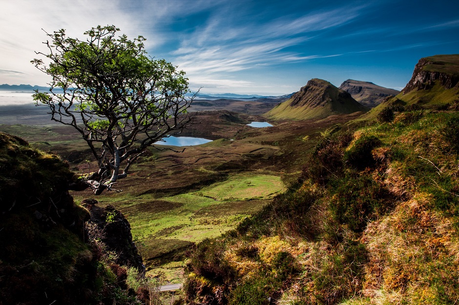
Photo Credit – https://www.123rf.com/photo_22816000_scenic-view-of-quiraing-mountains-in-isle-of-skye-scottish-highlands-united-kingdom.html
Photo Credit – HD Wallpaper – Free Download
